In detail#
The ARGOS platform can be accessed at https://app.argos-emergency.com with a previously provided username and password.

Main screen#
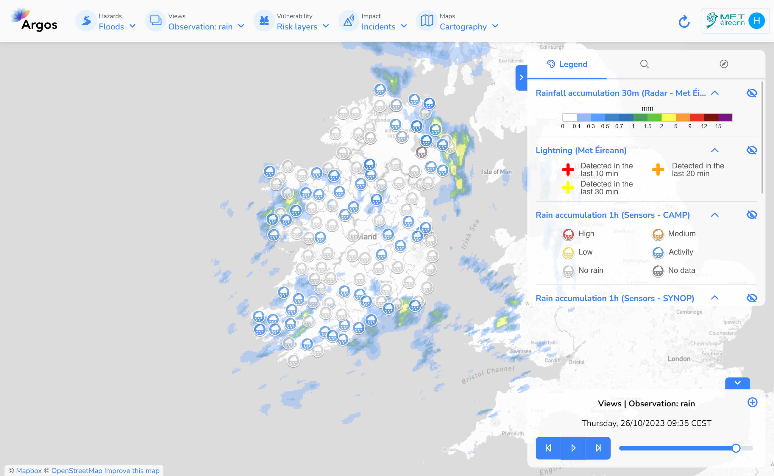
The main screen consists of a map centred on our account domain. At the top, we can find different menus. From left to right:
Hazard: Here you select the hazard of interest: floods, wind, forest fires, etc.
Hazard products: Real-time data related to the selected hazard is available here: sensors, weather forecasts or official warnings. The animation control at the bottom right allows you to navigate through the available time range.
Vulnerability information: Static information such as flood or risk areas.
Maps: Contains the available transversal information: base maps, road networks, administrative boundaries, etc.
User menu: Allows access to the configuration, but also links to the wiki or legal matters.
On the right hand side we can also find a section with three tabs:
Legend: Displays the legends of the layers loaded into the map. It also contains a slider to modify each layer’s opacity (eye icon).
Coordinates: Allows the user to display the coordinates of any point in the map, and also displays the values in alternative coordinate systems.
Search: Allows the user to search for cities, points of interest, etc. and provides a list of available options. Clicking any of the options moves the current view to the specified place.
